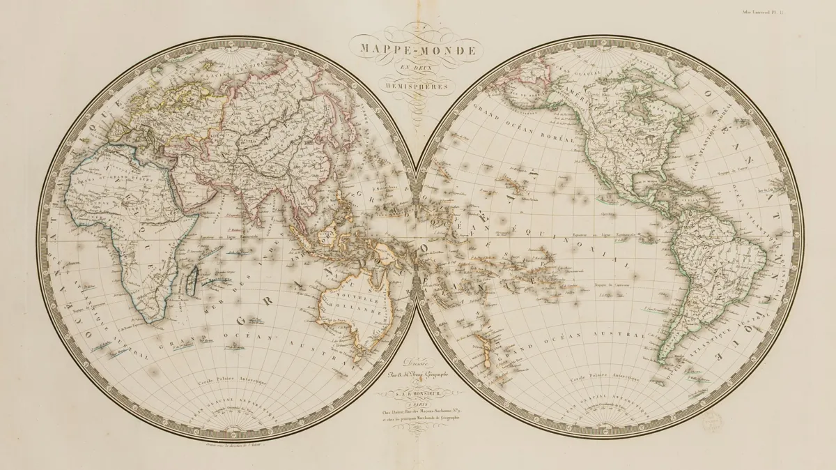
Description
Brué, A. H. Atlas universel de Géographie physique, politique et historique, ancienne et moderne. With engraved title and contents leaf as well as 36 double-page outline-coloured copper maps. Paris, author, 1822 (-1824). 1 leaf "Rapport ... par M. le Baron Alexandre de Humboldt sur l'Atlas". 52 x 36 cm. Red half-morocco binding of the period with gilt spine (heavily rubbed and bumped). First edition. - Cf. Phillips 758 (2nd edition).
Brué, A. H. Atlas universel de Géographie physique, politique et historique, ancienne et moderne. Mit gestochenem Titel und Inhaltsblatt sowie 36 doppelblattgroßen umrisskolorierten Kupferkarten. Paris, Autor, 1822 (-1824). 1 Bl. "Rapport ... par M. le Baron Alexandre de Humboldt sur l'Atlas". 52 x 36 cm. Roter Halbmaroquinband der Zeit mit Rückenvergoldung (stark berieben und bestoßen). Erste Ausgabe. - Vgl. Phillips 758 (2. Ausgabe). - Wissenschaftlicher Atlas mit 2 Weltkarten, 9 Karten der Alten Welt, 13 von Europa, 5 von Asien, je 1 von Ozeanien, Afrika und Ägypten sowie 4 des amerikanischen Kontinents. Die Karte der Vereinigten Staaten von Amerika mit Mexiko sowie Teilen Kanadas beruht auf den Expeditionsberichten von Lewis & Clark und Humboldt. Alle Karten mit Trockenstempel "Carte encyprotipe du fonds de l'auteur". - Ränder etwas fleckig, etliche Karten an den Enden der Fälze hinterlegt und teils wieder eingerissen.
Machine translation. The seller's German text is authoritative.
Sale conditions
According to the sale terms: « Aufbewahrung und Versand erfolgen auf Rechnung der Käufer; die Kosten für Versand, Verpackung und Versicherung werden mit der Gesamtrechnung berechnet. »
About the sale
Atlases – Brué, A. H. Atlas universel de Géographie physique, politique et historique, ancienne et moderne
Original titleAtlanten – Brué, A. H. Atlas universel de Géographie physique, politique et historique, ancienne et moderne. Mit gestochenem Titel und…

Similar lots
 No bids
 No bids
 No bids
 No bids