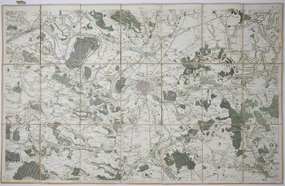
Description
C. F. Cassini de Thury, Paris, ca. 1763-90. Varying formats (numerous parts ca. 56 x 89 cm). Mostly mounted in 21 segments on linen, in 3 slightly damaged contemporary half-leather slipcases with 2 title labels each (linen partly heavily stained). The "Carte de France" or "Carte de Cassini" was the first map work depicting France on the basis of an accurate geodetic survey.
C. F. Cassini de Thury, (Paris), ca. 1763-90. Etw. unterschiedliche Formate (zahlreiche Tle. ca. 56 x 89 cm). - - Meist in 21 Segmenten auf Lwd. aufgezogen, in 3 etw. läd. Hldr.-Schubern d. Zt. mit je 2 Rsch. (Leinen tls. stärker fleckig). (24) Lex. Kart. S. 130. - Die "Carte de France" oder auch "Carte de Cassini" war das erste Kartenwerk, das Frankreich auf der Basis einer genauen geodätischen Vermessung darstellte. - Vorhanden sind folgende Blätter: 1 (Paris und Umgebung; altkolor.), 7, 10, 12, 13, 45-49, 79-87 (Nr. 82 altkolor.), 116 und 142-148 (142 altkolor.; Nr. 147 zusammen mit Nr. 116). - Die Blätter mit Schweizer Staatsgebiet, welches nicht dargestellt wurde, tls. in weniger Segmenten.
Machine translation. The seller's German text is authoritative.
Sale conditions
About the sale
Europe - France - Cassini - Carte de France, 27 parts, 27 engraved maps
Original titleEuropa - Frankreich - Cassini - Carte de France. Daraus 27 Teile. 27 Kupferstichkarten nach
Offered by

Similar lots
 No bids
 No bids
 No bids
 5 bids