Description
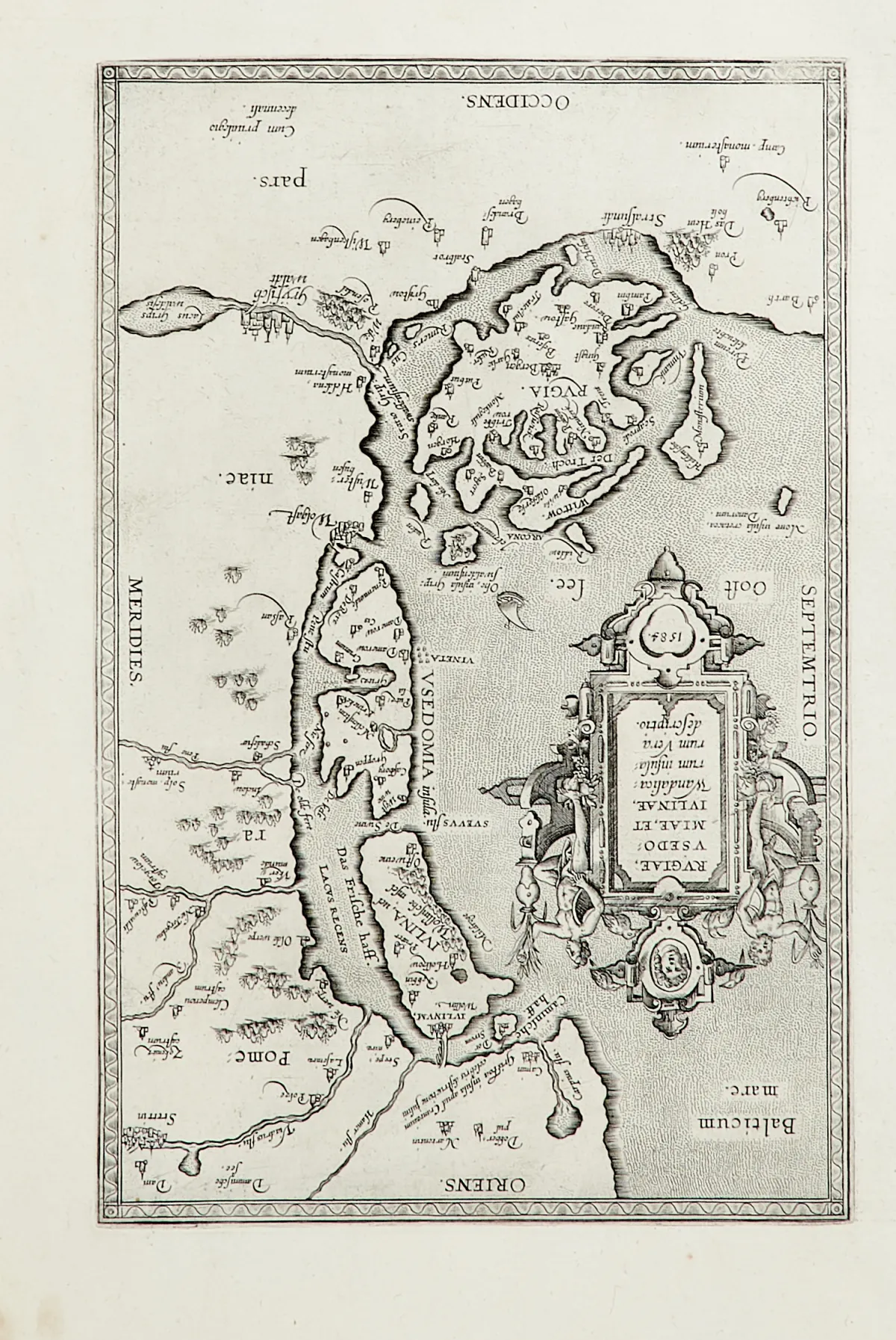
Copper engraving map, old-coloured, with uncoloured figural cartouche and uncoloured battle scene, by J. B. Homann in Nuremberg, around 1730. 48 x 56.5 cm. Some crease marks, somewhat stained and browned. Also included: "Rugiae, Usedomiae, et Iulinae Wandalicarum insularum Vera descriptio", copper engraving map, by A. Ortelius in Antwerp, dated 1584. 30.5 x 19.5 cm. Wide margins. Slightly stained and browned.
Pomeraniae Littoribus Nova Tabula". Altkolor. Kupferstichkarte mit unkolor. figürl. Kartusche und unkolor. Schlachtenszene, bei J. B. Homann in Nürnberg, um 1730. 48 x 56,5 cm. (25) - Einige Knickspuren, etw. fleckig und gebräunt. DAZU: "Rugiae, Usedomiae, et Iulinae Wandalicarum insularum Vera descriptio". Kupferstichkarte, bei A. Ortelius in Antwerpen, dat. 1584. 30,5 x 19,5 cm. - Breitrandig. - Leicht fleckig und gebräunt. - Beiliegt die restaurierte und angeränderte Kupferstichkarte "Nova famigerabilis insulae ac ducatus Rugiae descriptio" aus einem lateinischen Mercator-Hondius-Atlas. - Zus. 3 Blätter.
Machine translation. The seller's German text is authoritative.
Sale conditions
About the sale
Rügen - "Insulae et Principatus Rugiae cum vicinis"
Original titleRügen - "Insulae et Principatus Rugiae cum vicinis
Offered by

Similar lots
 1 bid
 1 bid
 No bids
 No bids