Description
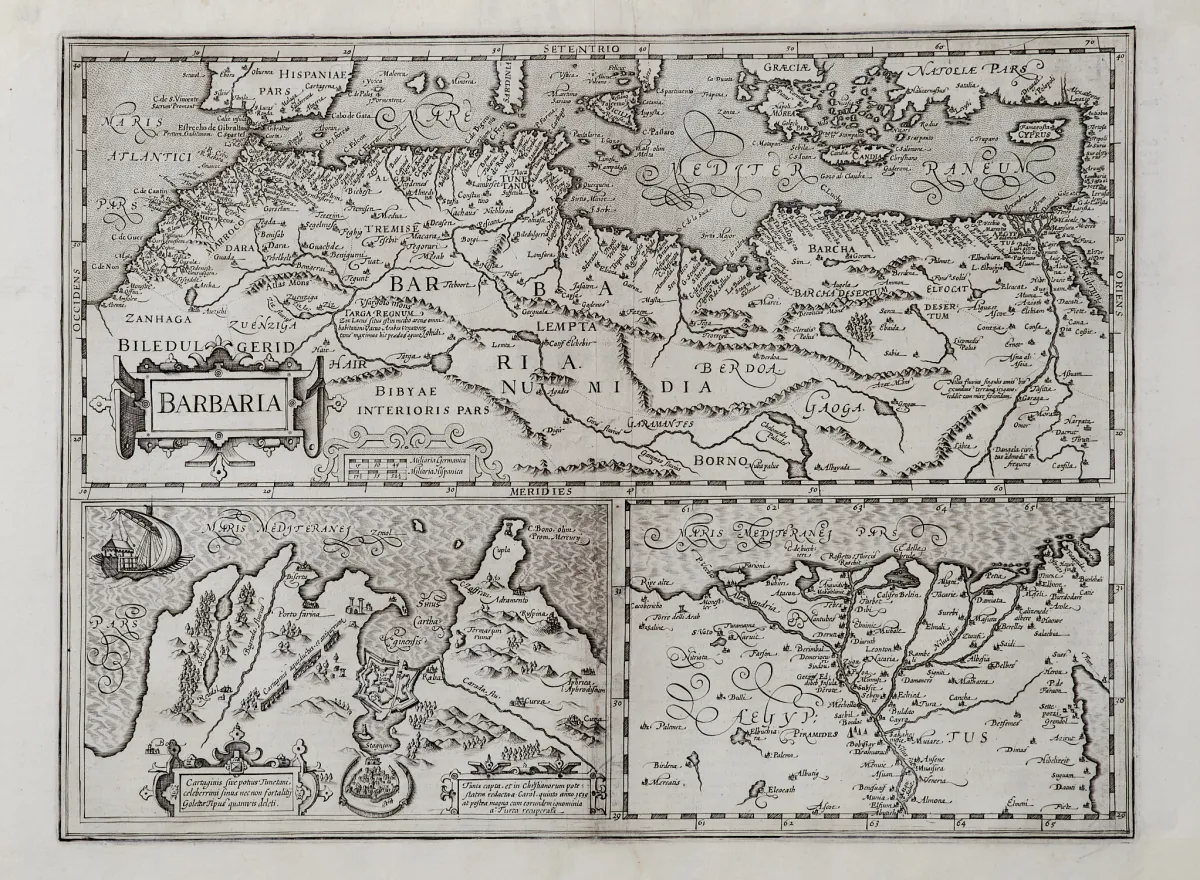
By various engravers and in different formats. 17th and 18th century. Approx. 18 x 25 to 48.5 x 57 cm. (25) - Including "Guinea" (published by G. Blaeu in Amsterdam; 2 copies) and "Aethiopia Superior vel Interior; vulgo Abissinorum" (probably by J. Janssonius in Amsterdam; 2 copies), "Barbaria" with 2 small inset maps of Carthage and the Nile Delta (probably from a Mercator-Hondius atlas), plus, for Russia, the maps in old colouring "Moscoviae".
von verschied. Stechern und in unterschiedlichen Formaten. 17. und 18. Jhdt. Ca. 18 x 25 bis 48,5 x 57 cm. (25) - Darunter "Guinea" (erschienen bei G. Blaeu in Amsterdam; 2 Exemplare) und "Aethiopia Superior vel Interior; vulgo Abissinorum" (wohl bei J. Janssonius in Amsterdam; 2 Exemplare), "Barbaria" mit 2 kleinen Nebenkarten von Karthago und dem Nildelta (wohl aus einem Mercator-Hondius-Atlas), dazu von Russland die altkolor. Karten "Moscoviae pars australis" (bei J. Janssonius) und "Generalis totius Imperii Russorum" (bei J. B. Homann in Nürnberg).
Machine translation. The seller's German text is authoritative.
Sale conditions
About the sale
Africa - Asia Russia - 9 engraved maps
Original titleAfrika - Asien Russland - 9 Kupferstichkarten
Offered by

Similar lots
 1 bid
 1 bid
 No bids
 No bids