Description
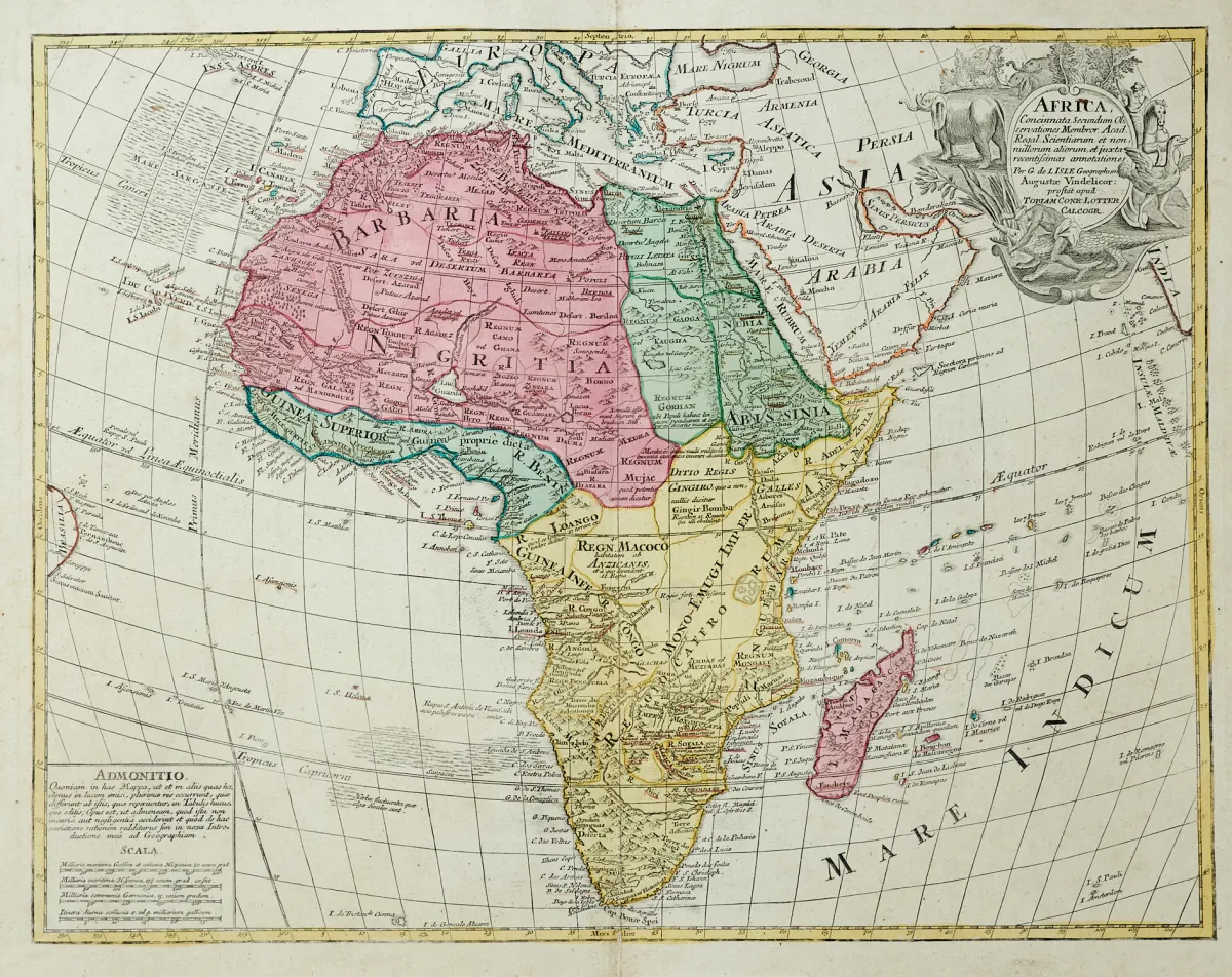
Engraved maps mostly of the 17th and 18th century by various engravers and in different formats (approx. 32.5 x 40.5 to 48 x 55 cm). (24) - Including 4 maps of the entire continent (Homann heirs, T. C. Lotter, at the Geographical Institute in Weimar and Chr. Weigel), the remaining sheets of North Africa, including "Barbaria" with small views of Carthage and the Nile Delta, probably from a French Mercator-Hondius-Janssonius atlas.
Kupferstichkarten meist des 17. und 18. Jhdts. von verschied. Stechern und in unterschiedlichen Formaten (ca. 32,5 x 40,5 bis 48 x 55 cm). (24) - Darunter 4 Karten des gesamten Kontinents (Homanns Erben, T. C. Lotter, im Georgraphischen Institut in Weimar sowie Chr. Weigel), die restlichen Blätter von Nordafrika, darunter "Barbaria" mit kleinen Ansichten von Karthago und dem Nildelta, wohl aus einem französischen Mercator-Hondius-Janssonius Atlas sowie "Statuum Maroccanorum" von Homann mit den Kanarischen Inseln und 2 Ansichten unter der Karte.
Machine translation. The seller's German text is authoritative.
Sale conditions
About the sale
Africa - Lot - 10 engraved maps, partly old hand-coloured
Original titleAfrika - Konvolut - 10 tls. alt grenzkolor. oder altkolor.
Offered by

Similar lots
 No bids
 No bids
 No bids
 No bids