Description
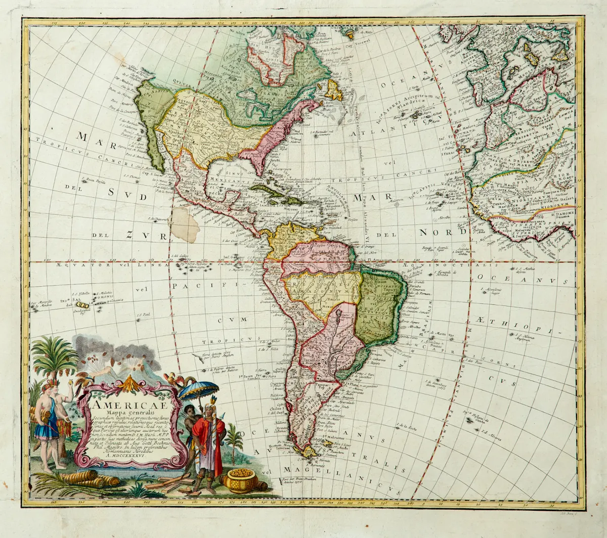
Engraved maps by various engravers and in different formats (approx. 47 x 53.5 to 59 x 63.5 cm). 18th and 19th century. (24) - 3 maps of the entire American continent with South America (2 x by Homann heirs and J. Walch), "Carte Générale des Etats-Unis" by P. Tardieu, dated 1840, and a map of the islands of Antigua, Barbados, Bermuda, Jamaica and St. Kitts (on one sheet) by Homann heirs.
Kupferstichkarten von verschied. Stechern und in unterschiedlichen Formaten (ca. 47 x 53,5 bis 59 x 63,5 cm). 18. und 19. Jhdt. (24) - 3 Karten des gesamten amerikanischen Kontinents mit Südamerika (2 x von Homanns Erben sowie J. Walch), "Carte Générale des Etats-Unis" von P. Tardieu, dat. 1840 sowie eine Karte der Inseln Antigua, Barbados, Bermudas, Jamaica sowie St. Kitts (auf einem Blatt) von Homanns Erben.
Machine translation. The seller's German text is authoritative.
Sale conditions
About the sale
America - 5 engraved maps, partly old hand-coloured
Original titleAmerika - 5 tls. alt grenzkolor. oder altkolor.
Offered by

Similar lots
 No bids
 No bids
 No bids
 No bids