Description
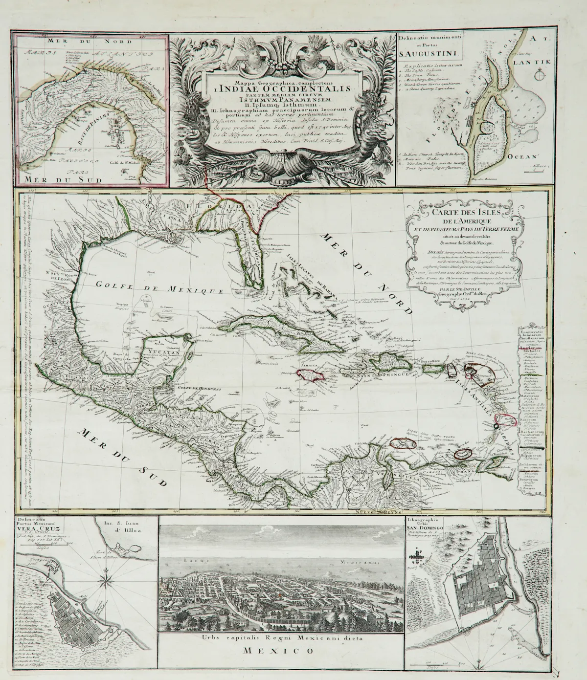
Old border-coloured copper engraving map with large uncoloured figurative title cartouche at top centre, at Homann's Heirs in Nuremberg, 1740 (in the map cartouche: D'Anville in Paris, dated 1731). Total size: 57 x 48.5 cm. Under passe-partout. Ref. Lowery 360; Kapp, Panama, 158. Map of Central America with 5 small inset maps, views and plans.
Occidentalis partem mediam circum Isthmum Panamensem ..." Alt grenzkolor. Kupferstichkarte mit großer unkolor. figürl. Titelkartusche oben mittig, bei Homanns Erben in Nürnberg, 1740 (in der Kartenkartusche: D'Anville in Paris, dat. 1731). Gesamtgr.: 57 x 48,5 cm. - - Unter Passepartout. (25) Lowery 360. Kapp, Panama, 158. - Karte von Mittelamerika mit 5 kleinen Nebenkarten, Ansichten und Plänen. - In der Mitte die Karte des Karibikraumes nach J.-B. d'Anville, links eine kleine Karte von Panama, rechts eine Umgebungskarte von St. Augustine (Florida). Im unteren Viertel Gesamtansicht von Mexiko-Stadt (9,5 x 22 cm), rechts und links davon Pläne von Veracruz in Mexiko und Santo Domingo in der Dominikanischen Republik.
Machine translation. The seller's German text is authoritative.
Sale conditions
About the sale
America - North America Caribbean - Geographical Map of Central America
Original titleAmerika - Nordamerika Karibik - "Mappa Geographica, complectens I. Indiae
Offered by

Similar lots
 No bids
 No bids
 No bids
 No bids