Description
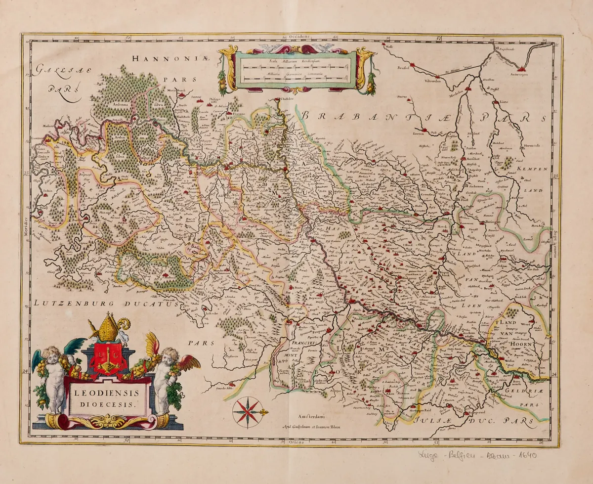
by various engravers and in different formats. Mostly 17th and 18th century. Approx. 31.5 x 41 to 60.5 x 86 cm. (25) - Including "Carte des entrées du Suyder-Zee et de l'Embs avec les Isles, Bancs et Costes..." (sea chart with inset map from "Le Neptune Francois", Paris dated 1693; 60.5 x 86 cm; Koeman IV, M. Mor 1, 6; heavy signs of age and use), "Ducatus Geldria et Zutphania comitatus" (published by N. Visscher in Amsterdam), "Rhinolan
von verschied. Stechern und in unterschiedlichen Formaten. Meist 17. und 18. Jhdt. Ca. 31,5 x 41 bis 60,5 x 86 cm. (25) - Darunter "Carte des entrées du Suyder-Zee et de l'Embs avec les Isles, Bancs et Costes..." (Seekarte mit Nebenkarte aus "Le Neptune Francois", Paris dat. 1693; 60,5 x 86 cm; Koeman IV, M. Mor 1, 6; starke Alters- und Gebrauchsspuren), "Ducatus Geldria et Zutphania comitatus" (erschienen bei N. Visscher in Amsterdam), "Rhinolandiae Amstelandiae" (bei H. Hondius in Amsterdam, dat. 1629), "Picardiae Belgicae regionis descriptio" (bei A. Ortelius, dat. 1579), "Leodiensis Dioecesis" (bei G. und J. Blaeu) sowie "Li Paesi Bassi Austriaci" (bei A. Zatta in Venedig, dat. 1780).
Machine translation. The seller's German text is authoritative.
Sale conditions
About the sale
- Benelux - 13 copperplate maps
Original title- Benelux - 13 Kupferstichkarten
Offered by

Similar lots
 No bids
 No bids
 No bids
 No bids