Description
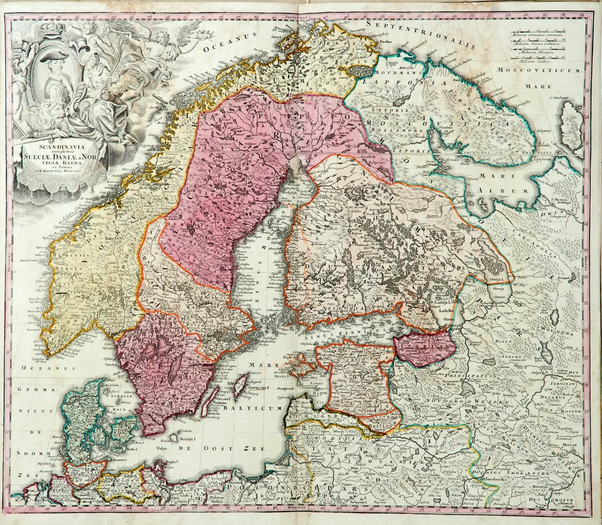
Maps of the 17th and 18th century by various engravers and in slightly different formats (approx. 37 x 48 to 50 x 57.5 cm). Including "Scandinavia complectens Sueciae, Daniae & Norvegiae Regna", all of Scandinavia with the Baltic and parts of Russia, 6 maps of Denmark, Finland, Iceland and Norway, the maps among others by, after and at D. Funcke, J. B. Homann, J. Janssonius, P. Schenk, M. Seutter and F. de Wit.
Kupferstichkarten des 17. und 18. Jhdts. von verschied. Stechern und in leicht unterschiedlichen Formaten (ca. 37 x 48 bis 50 x 57,5 cm). (24) - Darunter "Scandinavia complectens Sueciae, Daniae & Norvegiae Regna", ganz Skandinavien mit dem Baltkum und Teilen Russlands zeigend, 6 Karten von Dänemark, Finnland, Island und Norwegen, die Karten u.a. von, nach und bei D. Funcke, J. B. Homann, J. Janssonius, P. Schenk, M. Seutter und F. de Wit.
Machine translation. The seller's German text is authoritative.
Sale conditions
About the sale
Scandinavia - Lot - 10 copper engraving maps, partly border-coloured
Original titleSkandinavien - Konvolut - 10 tls. alt grenzkolor. oder altkolor.
Offered by

Similar lots
 No bids
 No bids
 No bids
 No bids