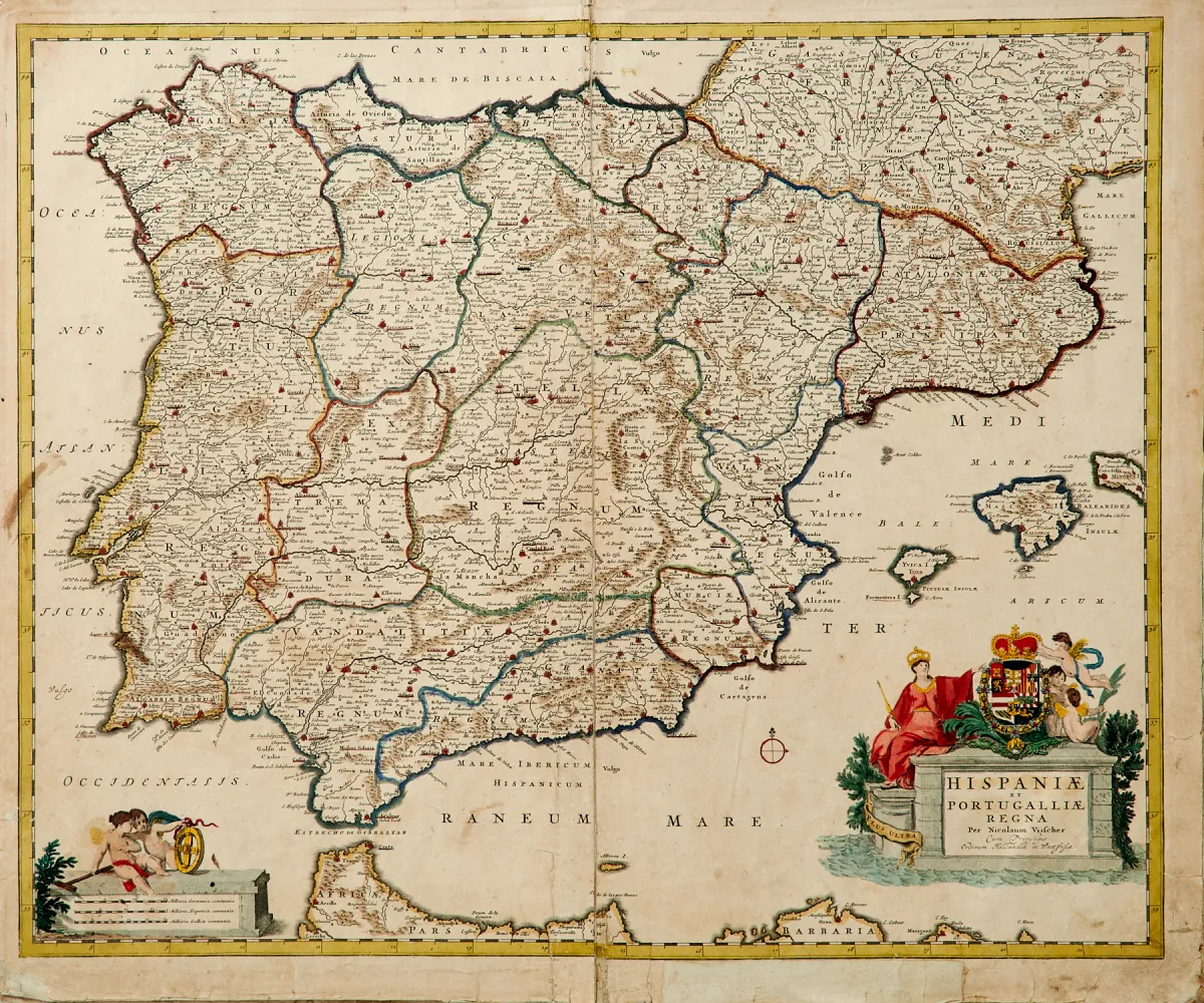
Description
Copper engraved maps by various engravers, slightly varying formats (approx. 35 x 47.5 to 49 x 56.5 cm). Including maps of the entire Iberian Peninsula, 2 sheets of Castile, the area around Gibraltar and Cadiz, and a map of Portugal with an inset of the possessions in Brazil, by and at G. Blaeu, J. Danckerts, J. B. Homann, C. Mannert, P. Mariette, among others.
Kupferstichkarten meist des 17. und 18. Jhdts. von verschied. Stechern und in leicht unterschiedlichen Formaten (ca. 35 x 47,5 bis 49 x 56,5 cm). (24) - Darunter Karten der gesamten Iberischen Halbinsel, 2 Blätter von Kastilien, dazu die Gegend um Gibraltar und Cadix sowie eine Karte von Portugal mit einer Nebenkarte der Besitzungen in Brasilien, die Karten u.a. von, nach und bei G. Blaeu, J. Danckerts, J. B. Homann, C. Mannert, P. Mariette, Schneider & Weigel, M. Seutter und I. Sommer.
Machine translation. The seller's German text is authoritative.
Sale conditions
About the sale
Spain and Portugal - Lot - 12 partly hand-coloured copper engraved maps, mostly 17th and 18th century
Original titleSpanien und Portugal - Konvolut - 12 tls. alt grenzkolor. oder altkolor.
Offered by

Similar lots
 No bids
 No bids
 No bids
 1 bid