Description
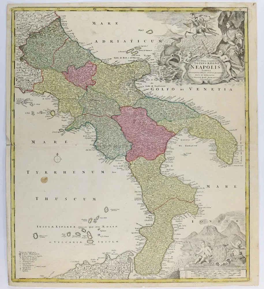
Map. "Novissima & exactissima Totius Regni Neapolis Tabula". Old-coloured copper engraving by J.B. Homann, Nuremberg, circa 1720. 54 x 47 cm. With uncoloured figural title cartouche in the upper right corner, small legend on the left and figural mile indicator with coat of arms and secondary view of Vesuvius in the lower right corner. Covers the area from Ascoli to northern Sicily. Present twice. Partly somewhat foxed and worn. Mounted on cardboard. Annotated in pen.
Landkarten. "Novissima & exactissima Totius Regni Neapolis Tabula". Altkolor. Kupferstichkte. bei J.B.Homann, Nbg. um 1720. 54 x 47 cm. Mit unkolor. figürl. Titelkartusche im rechten ob. Eck, kl. Legende im linken u. figürl. Meilenzeiger mit Wappen und Nebenansicht des Vesuv im rechten unteren Eck. Umfasst das Gebiet v. Ascoli bis Nordsizilien. Doppelt vorhanden. - Tls. etw. stockfl. u. gebr. Auf Kart. aufgez. M. Feder bez.
Machine translation. The seller's German text is authoritative.
Sale conditions
About the sale
Maps – "Novissima & exactissima Totius Regni Neapolis Tabula"
Original titleLandkarten. – "Novissima & exactissima Totius Regni Neapolis Tabula"
Offered by

Similar lots
 No bids
  No bids
  No bids
  No bids