Description
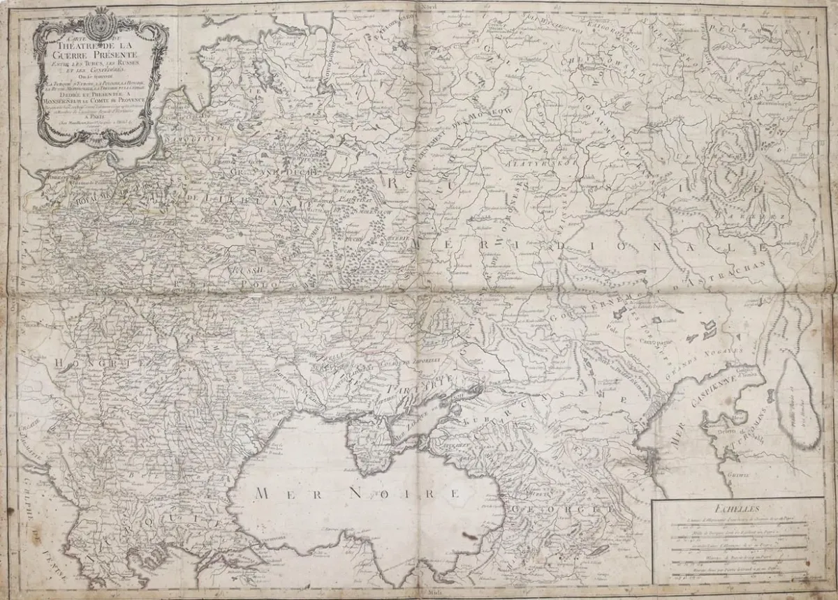
Black Sea. Carte Du Thatre De La Guerre Prsente Entre Les Turcs, Les Russes, Et Les Confdrs. Partly border-colored copper engraving map. By Laurent, Paris 1769. Mounted on linen. Verso num. 45.5 x 75.3 cm. Folded. - Browned, partly somewhat stained. Minor marginal tears and breaks along the fold. Included: The Russian Dominions in Europ. Colored copper engraving map. By J. Nantiat, by Wyld London 1808. Mounted on cardboard. 62 x 95.5 cm. - With
Schwarzes Meer. Carte Du Thatre De La Guerre Prsente Entre Les Turcs, Les Russes, Et Les Confdrs. Tls. grenzkolor. Kupferstichkarte. Von Laurent, Paris 1769. Auf Lw. aufgezogen. Verso Num. 45,5 x 75,3 cm. Gefaltet. - Gebräunt, stellenw. etwas fleckig. Kleinere Randläsuren u. Brüche entlang der Faltspur. Dabei: The Russian Dominions in Europ. Kolor. Kupferstichkarte. Von J. Nantiat, bei Wyld London 1808. Punkt. auf Karton mont. 62 x 95,5 cm. - Mittelfalz. Stellenw. leicht gebräunt. Kleinere Randläsuren.
Machine translation. The seller's German text is authoritative.
Sale conditions
About the sale
Black Sea. – Carte Du Thatre De La Guerre Prsente Entre Les Turcs, Les Russes, Et Les Confdrs
Original titleSchwarzes Meer. – Carte Du Thatre De La Guerre Prsente Entre Les Turcs, Les Russes, Et Les Confdrs
Offered by

Similar lots
 No bids
  No bids
  No bids
  No bids