Description
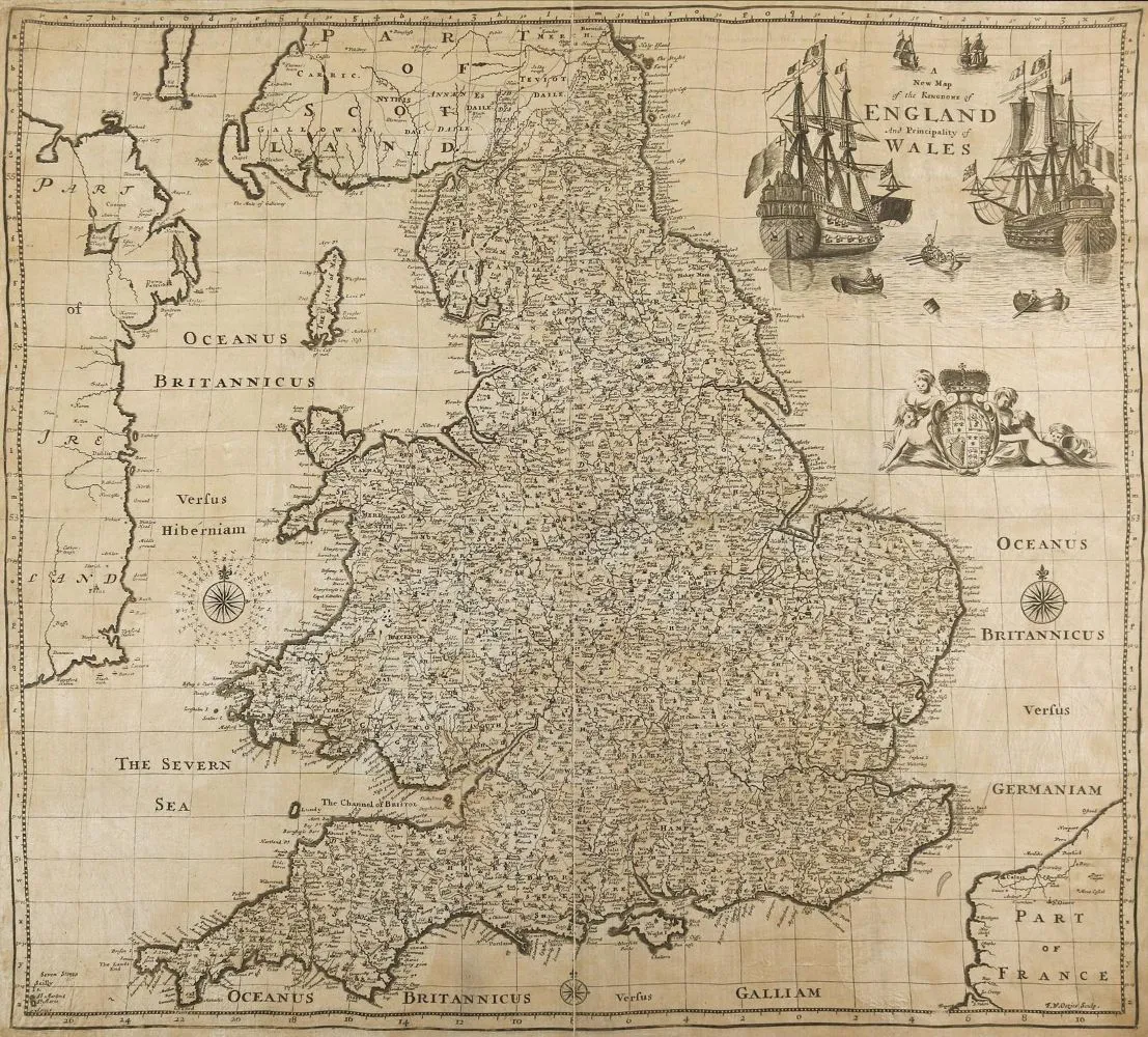
Grande-Bretagne. A new map of the Kingdom of England and the Principality of Wales. Carte gravée sur cuivre imprimée sur toile et collée sur papier. D'après F.W. Oetjes chez Robert Mordon, vers 1690. Taille de la planche 40 x 54 cm. Carte publiée séparément chez Mordon, rare. - Partiellement fortement brunie et avec des traces d'humidité jusque dans la représentation. Déchirure de pli jusque dans la représentation. - Ancienne collection Gert Nagel, Stuttgart.
Großbritannien. A new map of the Kingdom of England and the Principality of Wales. Kupferstichkarte auf Lw. gedurckt u. auf Papoer geklebt. Nach F.W. Oetjes bei Robert Mordon, ca. 1690. Plgr. 40 x 54 cm. Se perat erschienene Karte bei Mordon, selten. - Tls. stärker gebräunt u. bis in die Darstellung wasserrandig. Falzriß bis in die Darstellung. - Ex-Sammlung Gert Nagel, Stuttgart.
Traduction automatique. Le texte allemand de la maison de ventes fait foi.
Conditions de vente
À propos de la vente
Grande-Bretagne. – A new map of the Kingdom of England and the Principality of Wales
Titre d'origineGroßbritannien. – A new map of the Kingdom of England and the Principality of Wales
Proposé par

Lots similaires
 11 enchères
  Sans enchère