Description
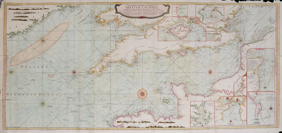
Sea chart. Coloured copper engraved map (from 3 plates) with 9 coloured inset maps, coloured coastal profiles as well as some coloured compass roses, after Thomas Jeffreys, at R. Sayer & J. Bennett in London, dated 1781. 69 x 151.5 cm. - - Rolled. (25) Shows the coastal area between the south-eastern part of Ireland approximately up to the Thames estuary as well as the French coast between Brest and Flanders, di
Channel with part of the Atlantic Ocean as far as Cape Clear". Seekarte. Kolor. Kupferstichkarte (von 3 Platten) mit 9 kolor. Nebenkarten, kolor. Küstenprofilen sowie einigen kolor. Kompassrosen, nach Thomas Jeffreys, bei R. Sayer & J. Bennett in London, dat. 1781. 69 x 151,5 cm. - - Gerollt. (25) Zeigt das Küstengebiet zwischen dem südöstlichen Teil von Irland ca. bis zur Themsemündung sowie die französische Küste zwischen Brest und Flandern, die Nebenkarten u.a. mit den Häfen von "the Downs", Falmouth, "Mounts Bay", Plymouth, Portland sowie die Umgebung der Isle of Wight.
Machine translation. The seller's German text is authoritative.
Sale conditions
About the sale
Great Britain - France Channel - "A new hydrographical survey of the British Channel with part of the Atlantic Ocean as far as Cape Clear"
Original titleGrossbritannien - Frankreich Kanal - "A new hydrographical survey of the British
Offered by

Similar lots
 No bids
 No bids
 No bids
 No bids