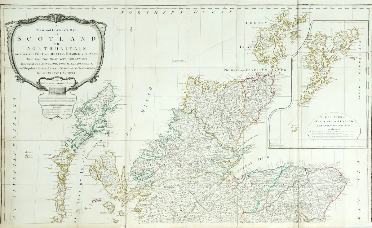
Descripción
Con todos los caminos postales y militares, divisiones, etc. Mapa grabado en cobre con coloreado antiguo de bordes (de 4 planchas) en 2 hojas (sin unir) con gran cartela titular sin colorear, mapa auxiliar y tabla de distancias, según R. Campbell, en Laurie & Whittle en Londres, fechado 1794. Aprox. 125 x 106 cm (tamaño total). - Plegado varias veces. (24) El mapa auxiliar (36 x 28,5 cm) muestra las islas Shetland. - Numerosos [daños] en parte pegados al verso o detrás
Britain with all the Post and Military Roads, Divisions &ca.". Alt grenzkolor. Kupferstichkarte (von 4 Platten) in 2 Blättern (nicht zusammengesetzt) mit großer unkolor. Titelkartusche, Nebenkarte sowie Tabelle mit den Entfernungen, nach R. Campbell, bei Laurie & Whittle in London, dat. 1794. Ca. 125 x 106 cm (Gesamtgr.). - - Mehrf. gefaltet. (24) Die Nebenkarte (36 x 28,5 cm) zeigt die Shetlandinseln. - Zahlreiche tls. verso geklebte oder hinterlegte Einrisse (vereinzelt minimaler Bildverlust), Randläsuren, leicht fleckig und gebräunt.
Traducción automática. Prevalece el texto alemán de la casa de subastas.
Condiciones de venta
Sobre la subasta
Gran Bretaña - "A New and Correct Map of Scotland or North Britain..."
Título original- Grossbritannien - "A New and Correct Map of Scotland or North
Ofrecido por

Lotes similares
 Sin puja
 Sin puja
 Sin puja