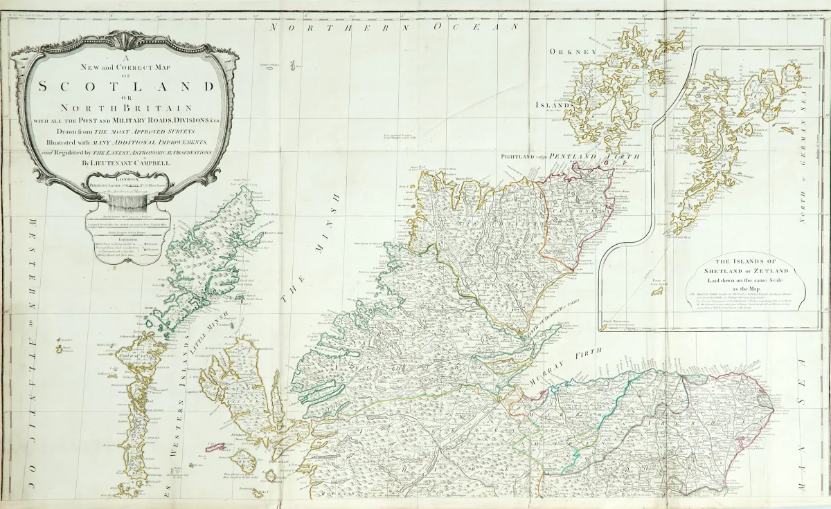
Description
Old border-coloured copper engraved map (from 4 plates) in 2 sheets (not assembled) with large uncoloured title cartouche, inset map and table of distances, after R. Campbell, by Laurie & Whittle in London, dated 1794. Approx. 125 x 106 cm overall. Multiple folds. The inset map (36 x 28.5 cm) shows the Shetland Islands.
Britain with all the Post and Military Roads, Divisions &ca.". Alt grenzkolor. Kupferstichkarte (von 4 Platten) in 2 Blättern (nicht zusammengesetzt) mit großer unkolor. Titelkartusche, Nebenkarte sowie Tabelle mit den Entfernungen, nach R. Campbell, bei Laurie & Whittle in London, dat. 1794. Ca. 125 x 106 cm (Gesamtgr.). - - Mehrf. gefaltet. (24) Die Nebenkarte (36 x 28,5 cm) zeigt die Shetlandinseln. - Zahlreiche tls. verso geklebte oder hinterlegte Einrisse (vereinzelt minimaler Bildverlust), Randläsuren, leicht fleckig und gebräunt.
Machine translation. The seller's German text is authoritative.
Sale conditions
About the sale
Great Britain - "A New and Correct Map of Scotland or North Britain"
Original title- Grossbritannien - "A New and Correct Map of Scotland or North
Offered by

Similar lots
 No bids
 No bids
 No bids