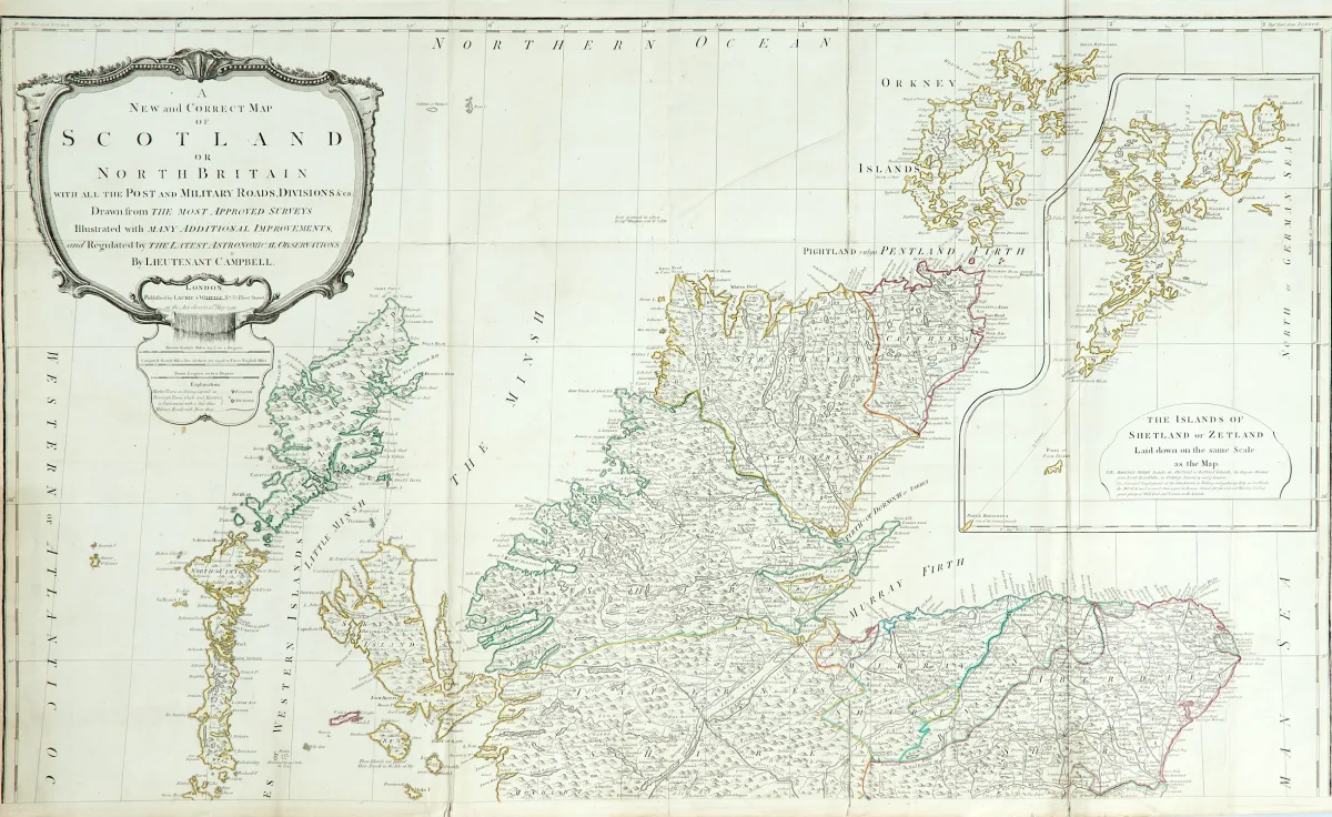
Stara miedziorytowa mapa (z 4 płyt) na 2 arkuszach (niezłożonych), z dawnym kolorowaniem granic, z dużą niekolorowaną kartuszą tytułową, mapką dodatkową i tabelą odległości, według R. Campbella, u Laurie & Whittle w Londynie, datowana 1794. Ok. 125 x 106 cm łącznie. Wielokrotnie składana. Mapka dodatkowa (36 x 28,5 cm) przedstawia Szetlandy.
Britain with all the Post and Military Roads, Divisions &ca.". Alt grenzkolor. Kupferstichkarte (von 4 Platten) in 2 Blättern (nicht zusammengesetzt) mit großer unkolor. Titelkartusche, Nebenkarte sowie Tabelle mit den Entfernungen, nach R. Campbell, bei Laurie & Whittle in London, dat. 1794. Ca. 125 x 106 cm (Gesamtgr.). - - Mehrf. gefaltet. (24) Die Nebenkarte (36 x 28,5 cm) zeigt die Shetlandinseln. - Zahlreiche tls. verso geklebte oder hinterlegte Einrisse (vereinzelt minimaler Bildverlust), Randläsuren, leicht fleckig und gebräunt.
Tłumaczenie automatyczne. Wiążący jest niemiecki tekst sprzedawcy.
Warunki sprzedaży
O aukcji
Wielka Brytania - "A New and Correct Map of Scotland or North Britain"
Tytuł oryginalny- Grossbritannien - "A New and Correct Map of Scotland or North
Oferowane przez

Podobne partie
 Bez ofert
 Bez ofert
 Bez ofert