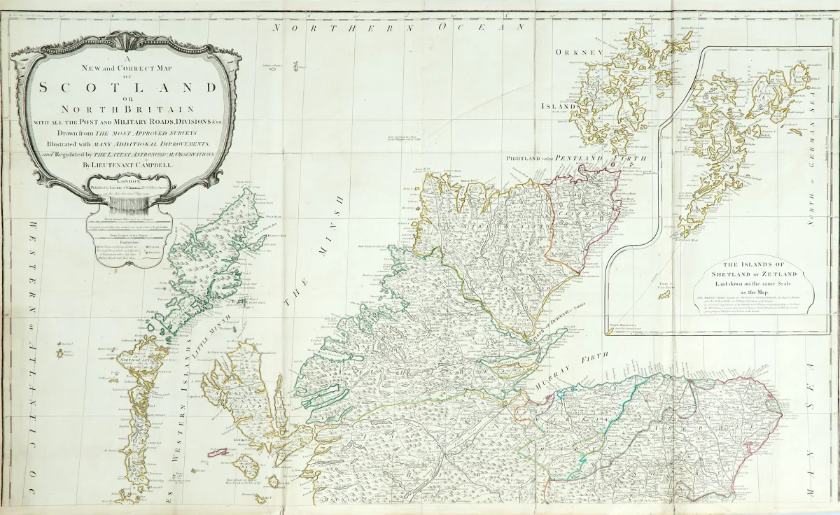
包含所有邮政和军事道路、分区等。旧式边界着色铜版地图(由4块版组成),分2张纸(未拼接),带大幅未着色标题饰框、附图以及距离表,依据R. Campbell,由伦敦Laurie & Whittle出版,日期1794年。约125 x 106厘米(总尺寸)。- 多次折叠。(24) 附图(36 x 28.5厘米)显示设得兰群岛。- 多处部分背面粘贴或衬
Britain with all the Post and Military Roads, Divisions &ca.". Alt grenzkolor. Kupferstichkarte (von 4 Platten) in 2 Blättern (nicht zusammengesetzt) mit großer unkolor. Titelkartusche, Nebenkarte sowie Tabelle mit den Entfernungen, nach R. Campbell, bei Laurie & Whittle in London, dat. 1794. Ca. 125 x 106 cm (Gesamtgr.). - - Mehrf. gefaltet. (24) Die Nebenkarte (36 x 28,5 cm) zeigt die Shetlandinseln. - Zahlreiche tls. verso geklebte oder hinterlegte Einrisse (vereinzelt minimaler Bildverlust), Randläsuren, leicht fleckig und gebräunt.
自动翻译。以拍卖行的德语文本为准。
关于拍卖
英国 - "A New and Correct Map of Scotland or North Britain..."
原始标题- Grossbritannien - "A New and Correct Map of Scotland or North

相似拍品
 无出价
 无出价
 无出价