الوصف
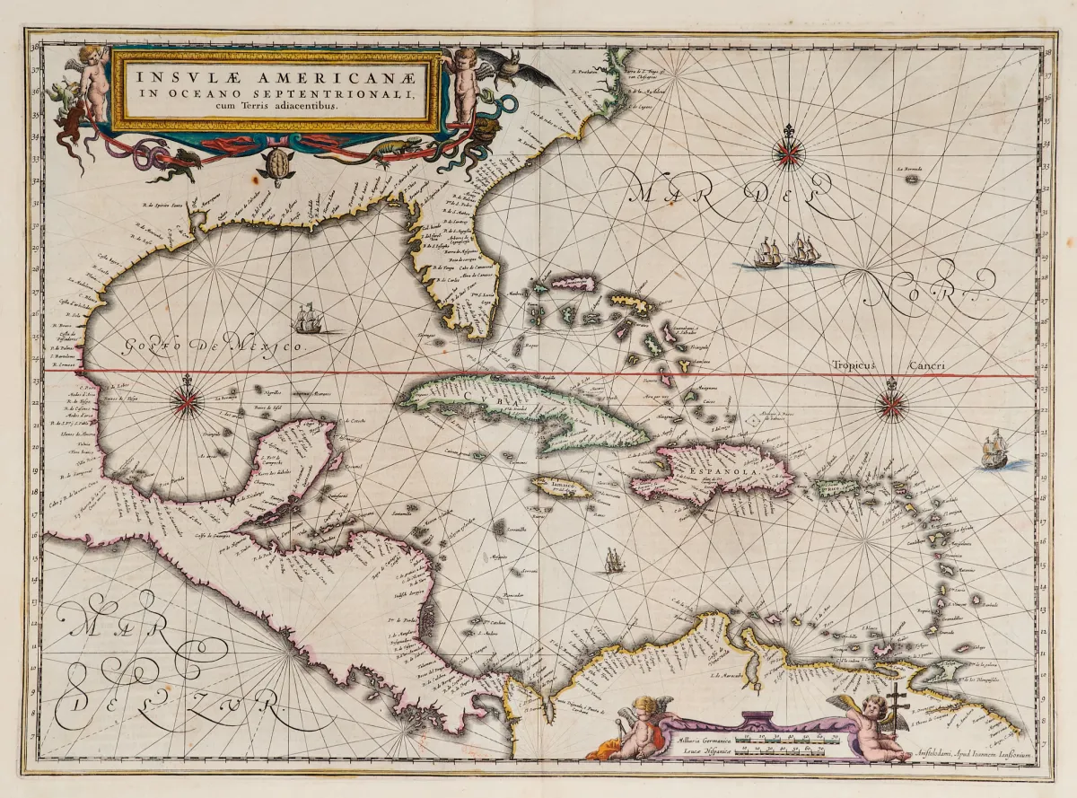
خريطة قديمة بحدود ملوّنة يدويًا (مع الطرف الجنوبي لفلوريدا وأمريكا الوسطى). نقش نحاسي مع خرطوشتين مصوّرتين ملوّنتين، وزخارف سفن وورود بوصلة، من «Newer Atlas»، لدى J. Janssonius في أمستردام، 1644–58. 37,5 × 51,5 سم. Van der Krogt I, 9600:1 1:424/27. Burden 248 (الحالة 1 من 2).
Terris adiacentibus" (mit der Südspitze Floridas und Mittelamerika). Alt grenzkolor. Kupferstichkarte mit 2 kolor. figürl. Kartuschen, Schiffsstaffage und Kompassrosen, aus "Newer Atlas", bei J. Janssonius in Amsterdam, 1644-58. 37,5 x 51,5 cm. (25) - Van der Krogt I, 9600:1 1:424/27. Burden 248 (state 1 of 2): "Here Janssonius, Hondius' partner, uses the Blaeu map of the same title produced the previous year. Cartographically the map draws on the extremely rare chart by Hessel Gerritsz, c. 1631, reflecting the firsthand knowledge of Gerritsz during his voyage to South America and the West Indies undertaken in 1628". - Mit deutschem Rückentext.
ترجمة آلية. النص الألماني لدار المزادات هو المعتمد.
شروط البيع
عن البيع
أمريكا — الكاريبي — «Insulae Americanae in Oceano Septentrionali, cum Terris adiacentibus»
العنوان الأصليAmerika - Karibik - "Insulae Americanae in Oceano Septentrionali, cum
مقدَّم من

قطع مشابهة
 بدون مزايدة
 بدون مزايدة
 بدون مزايدة
 بدون مزايدة