Açıklama
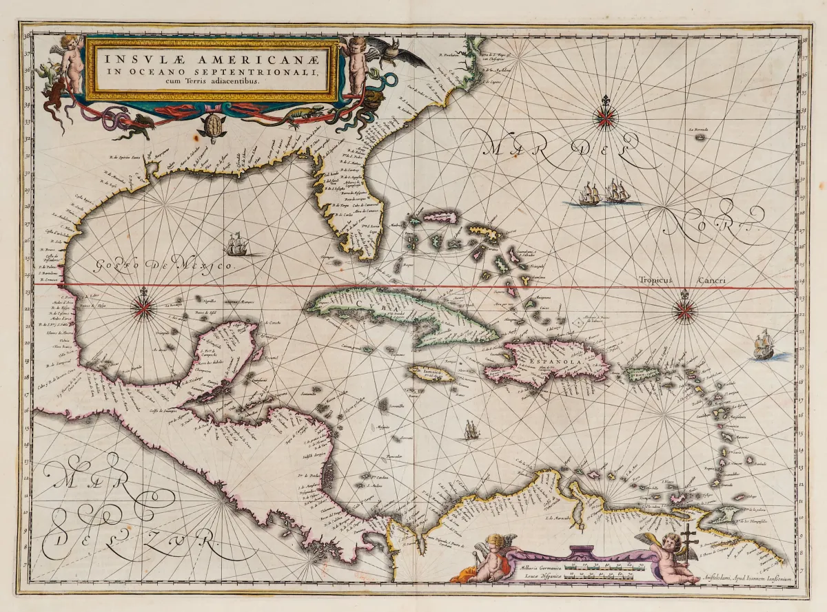
Eski, sınırları elle renklendirilmiş harita (Florida'nın güney ucu ve Orta Amerika ile). 2 renkli figürlü kartuş, gemi tasvirleri ve pusula gülleri içeren bakır gravür, „Newer Atlas”tan, J. Janssonius, Amsterdam, 1644–58. 37,5 x 51,5 cm. Van der Krogt I, 9600:1 1:424/27. Burden 248 (2'nin 1. durumu).
Terris adiacentibus" (mit der Südspitze Floridas und Mittelamerika). Alt grenzkolor. Kupferstichkarte mit 2 kolor. figürl. Kartuschen, Schiffsstaffage und Kompassrosen, aus "Newer Atlas", bei J. Janssonius in Amsterdam, 1644-58. 37,5 x 51,5 cm. (25) - Van der Krogt I, 9600:1 1:424/27. Burden 248 (state 1 of 2): "Here Janssonius, Hondius' partner, uses the Blaeu map of the same title produced the previous year. Cartographically the map draws on the extremely rare chart by Hessel Gerritsz, c. 1631, reflecting the firsthand knowledge of Gerritsz during his voyage to South America and the West Indies undertaken in 1628". - Mit deutschem Rückentext.
Otomatik çeviri. Satış evinin Almanca metni geçerlidir.
Satış koşulları
Satış hakkında
Amerika — Karayipler — „Insulae Americanae in Oceano Septentrionali, cum Terris adiacentibus”
Orijinal başlıkAmerika - Karibik - "Insulae Americanae in Oceano Septentrionali, cum
Sunan

Benzer lotlar
 Teklifsiz
 Teklifsiz
 Teklifsiz
 Teklifsiz