Описание
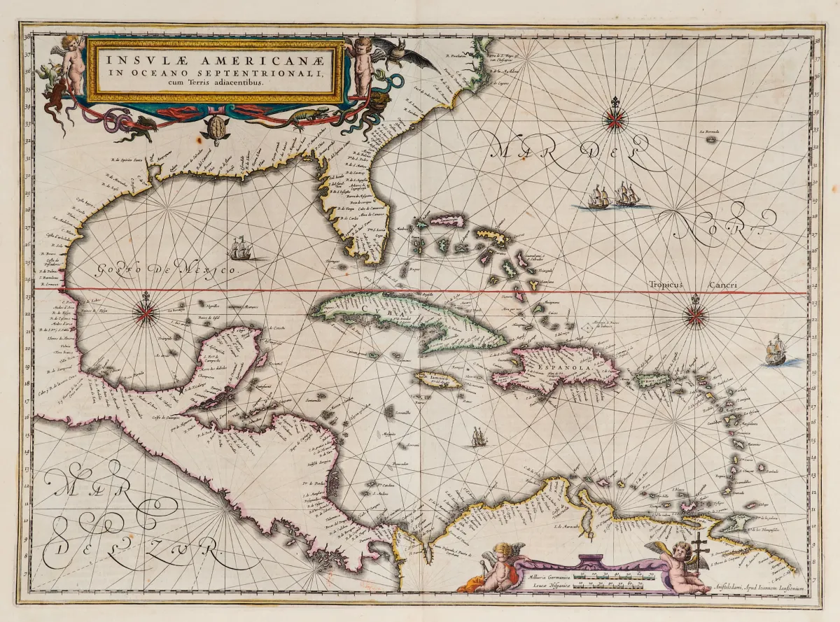
Старинная медная гравированная карта с ручной раскраской границ, с 2 раскрашенными фигурными картушами, изображениями кораблей и розами ветров, из "Newer Atlas", у J. Janssonius в Амстердаме, 1644-58. 37,5 x 51,5 см. Van der Krogt I, 9600:1 1:424/27. Burden 248 (состояние 1 из 2).
Terris adiacentibus" (mit der Südspitze Floridas und Mittelamerika). Alt grenzkolor. Kupferstichkarte mit 2 kolor. figürl. Kartuschen, Schiffsstaffage und Kompassrosen, aus "Newer Atlas", bei J. Janssonius in Amsterdam, 1644-58. 37,5 x 51,5 cm. (25) - Van der Krogt I, 9600:1 1:424/27. Burden 248 (state 1 of 2): "Here Janssonius, Hondius' partner, uses the Blaeu map of the same title produced the previous year. Cartographically the map draws on the extremely rare chart by Hessel Gerritsz, c. 1631, reflecting the firsthand knowledge of Gerritsz during his voyage to South America and the West Indies undertaken in 1628". - Mit deutschem Rückentext.
Автоматический перевод. Юридическую силу имеет немецкий текст аукционного дома.
Условия продажи
О продаже
Америка - Карибы - "Insulae Americanae in Oceano Septentrionali, cum Terris adiacentibus"
Оригинальное названиеAmerika - Karibik - "Insulae Americanae in Oceano Septentrionali, cum
Предлагает

Похожие лоты
 Без ставок
 Без ставок
 Без ставок
 Без ставок