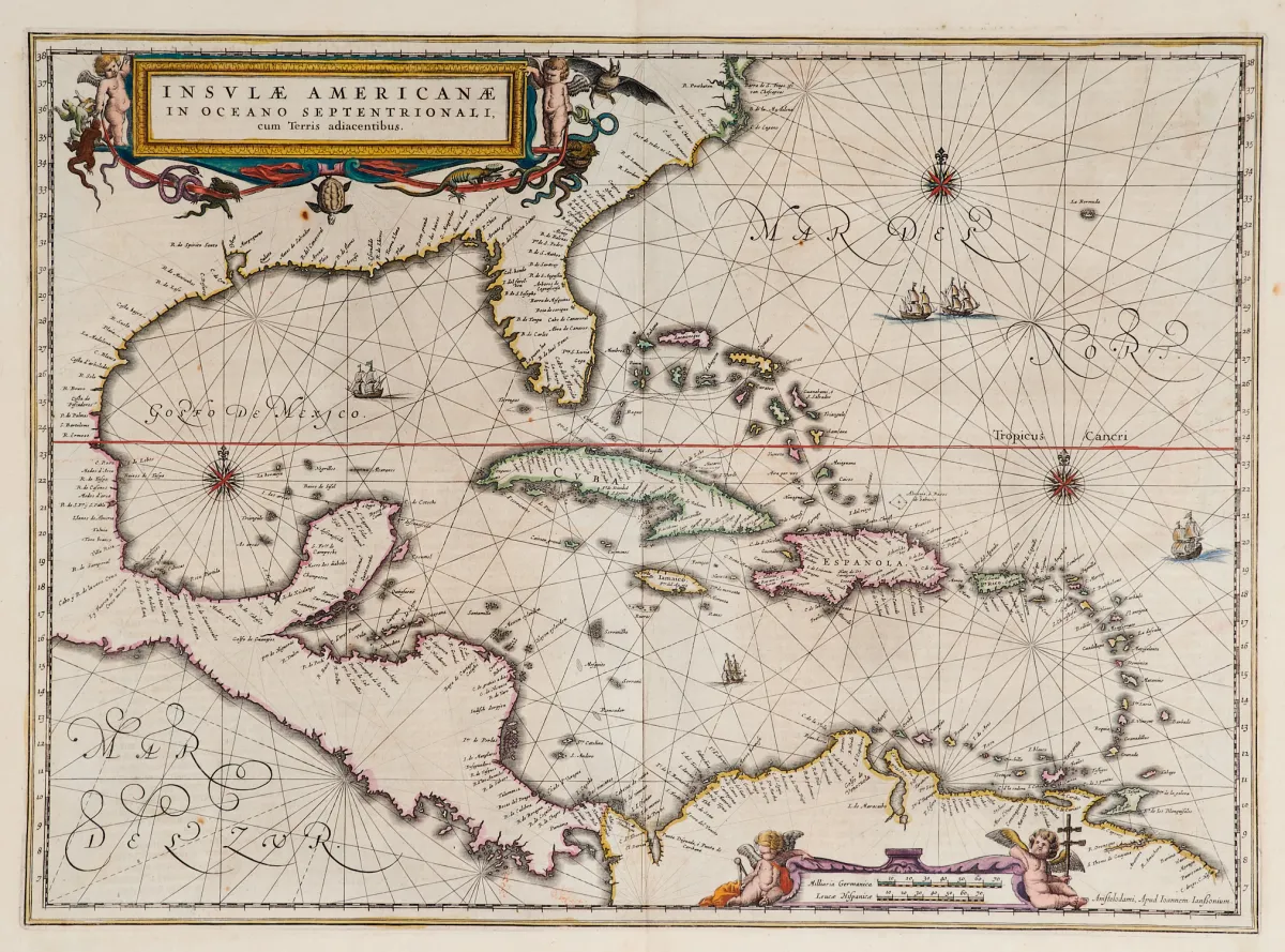
Старовинна карта з розфарбованими вручну межами (з південним краєм Флориди та Центральною Америкою). Гравюра на міді з 2 розфарбованими фігурними картушами, зображеннями кораблів і компасними розами, з «Newer Atlas», у J. Janssonius в Амстердамі, 1644–58. 37,5 x 51,5 см. Van der Krogt I, 9600:1 1:424/27. Burden 248 (стан 1 з 2).
Terris adiacentibus" (mit der Südspitze Floridas und Mittelamerika). Alt grenzkolor. Kupferstichkarte mit 2 kolor. figürl. Kartuschen, Schiffsstaffage und Kompassrosen, aus "Newer Atlas", bei J. Janssonius in Amsterdam, 1644-58. 37,5 x 51,5 cm. (25) - Van der Krogt I, 9600:1 1:424/27. Burden 248 (state 1 of 2): "Here Janssonius, Hondius' partner, uses the Blaeu map of the same title produced the previous year. Cartographically the map draws on the extremely rare chart by Hessel Gerritsz, c. 1631, reflecting the firsthand knowledge of Gerritsz during his voyage to South America and the West Indies undertaken in 1628". - Mit deutschem Rückentext.
Автоматичний переклад. Вирішальним є німецький текст аукціонного дому.
Умови продажу
Про торги
Америка — Кариби — «Insulae Americanae in Oceano Septentrionali, cum Terris adiacentibus»
Оригінальна назваAmerika - Karibik - "Insulae Americanae in Oceano Septentrionali, cum
Пропонує

Схожі лоти
 Без ставки
 Без ставки
 Без ставки
 Без ставки