Descripción
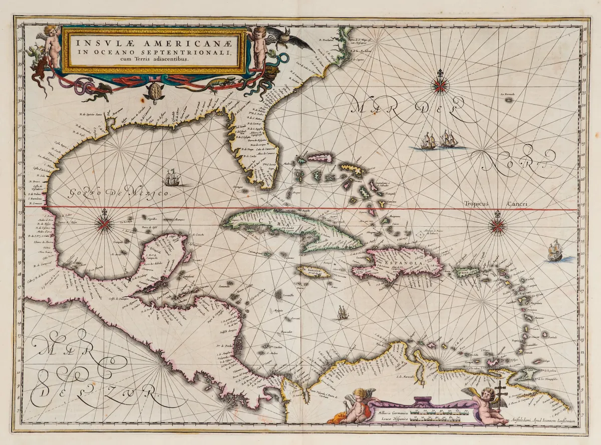
Terris adiacentibus (con el extremo sur de Florida y Centroamérica). Mapa grabado al cobre con coloreado antiguo de bordes, 2 cartelas figurativas coloreadas, figuras de barcos y rosas de los vientos, de "Newer Atlas", en J. Janssonius en Ámsterdam, 1644-58. 37,5 x 51,5 cm. (25) - Van der Krogt I, 9600:1 1:424/27. Burden 248 (estado 1 de 2): "Here Janssonius, Hondius' partner, uses the Blaeu map of the same title produced the previous year. Cartographically the map draws on th
Terris adiacentibus" (mit der Südspitze Floridas und Mittelamerika). Alt grenzkolor. Kupferstichkarte mit 2 kolor. figürl. Kartuschen, Schiffsstaffage und Kompassrosen, aus "Newer Atlas", bei J. Janssonius in Amsterdam, 1644-58. 37,5 x 51,5 cm. (25) - Van der Krogt I, 9600:1 1:424/27. Burden 248 (state 1 of 2): "Here Janssonius, Hondius' partner, uses the Blaeu map of the same title produced the previous year. Cartographically the map draws on the extremely rare chart by Hessel Gerritsz, c. 1631, reflecting the firsthand knowledge of Gerritsz during his voyage to South America and the West Indies undertaken in 1628". - Mit deutschem Rückentext.
Traducción automática. Prevalece el texto alemán de la casa de subastas.
Condiciones de venta
Sobre la subasta
América - Caribe - "Insulae Americanae in Oceano Septentrionali, cum"
Título originalAmerika - Karibik - "Insulae Americanae in Oceano Septentrionali, cum
Ofrecido por

Lotes similares
 Sin puja
 Sin puja
 Sin puja