Popis
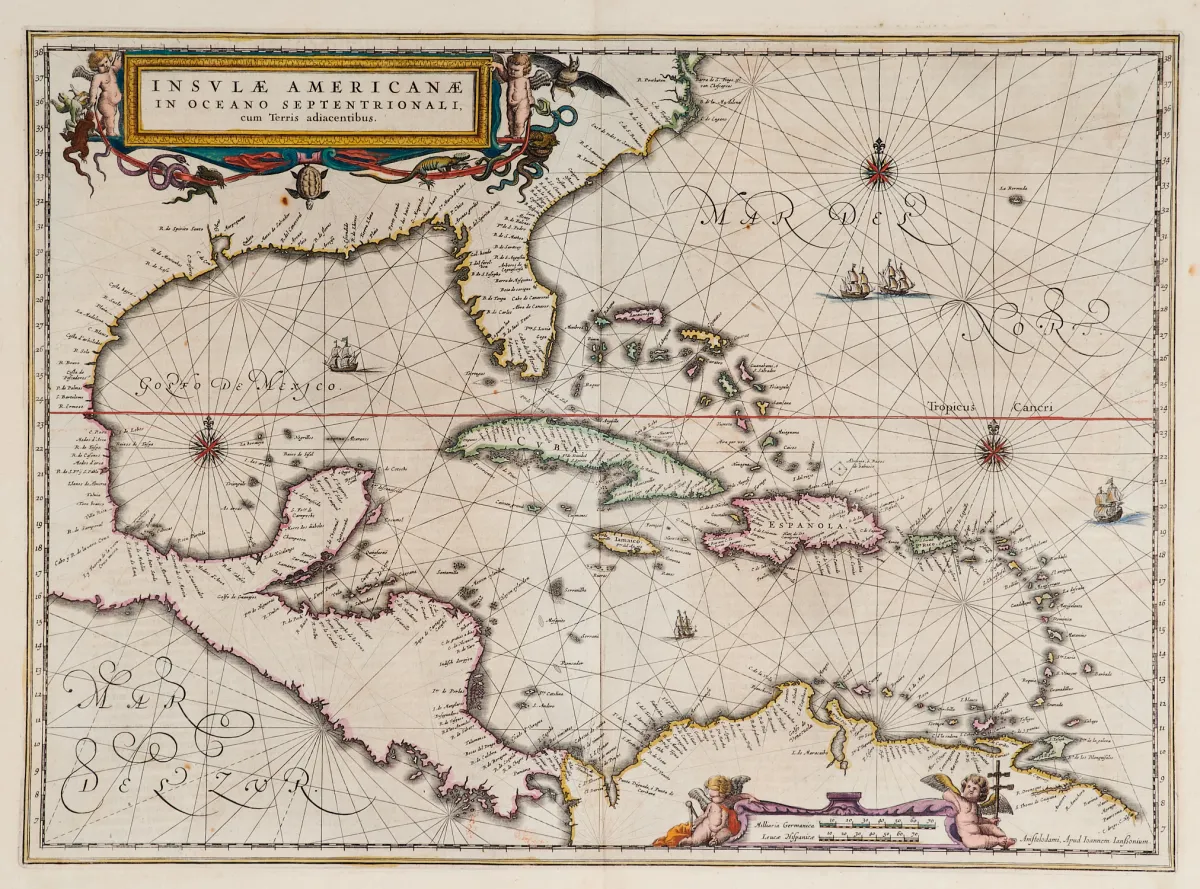
Stará ručně kolorovaná mědirytinová mapa se 2 kolorovanými figurálními kartušemi, loděmi a kompasovými růžicemi, z "Newer Atlas", u J. Janssoniusa v Amsterdamu, 1644-58. 37,5 x 51,5 cm. Van der Krogt I, 9600:1 1:424/27. Burden 248 (stav 1 ze 2).
Terris adiacentibus" (mit der Südspitze Floridas und Mittelamerika). Alt grenzkolor. Kupferstichkarte mit 2 kolor. figürl. Kartuschen, Schiffsstaffage und Kompassrosen, aus "Newer Atlas", bei J. Janssonius in Amsterdam, 1644-58. 37,5 x 51,5 cm. (25) - Van der Krogt I, 9600:1 1:424/27. Burden 248 (state 1 of 2): "Here Janssonius, Hondius' partner, uses the Blaeu map of the same title produced the previous year. Cartographically the map draws on the extremely rare chart by Hessel Gerritsz, c. 1631, reflecting the firsthand knowledge of Gerritsz during his voyage to South America and the West Indies undertaken in 1628". - Mit deutschem Rückentext.
Strojový překlad. Rozhodující je německý text prodejce.
Podmínky prodeje
O aukci
Amerika - Karibik - "Insulae Americanae in Oceano Septentrionali, cum Terris adiacentibus"
Původní názevAmerika - Karibik - "Insulae Americanae in Oceano Septentrionali, cum
Nabízí

Podobné položky
 Bez příhozu
 Bez příhozu
 Bez příhozu
 Bez příhozu